Personalization at scale is the norm of today’s business landscape. Every solution that deals with data requires context to understand and use the data. Applications can be anywhere between ambitious to customary. From AI-based bots to Social Networking, Rentals, Real estate, Dating, Job search, E-commerce - each solution utilizes a geolocation layer to tailor content and personalize feed for users.


What you have
- Area/ address
- GPS Coordinates, from a users’ device

What your user needs
- Geographically relevant jobs, properties, restaurants, dates, service centers etc etc

How you bridge the gap
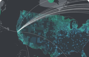
- The address sent by the users is converted into coordinates. Your systems draw a radius based on acceptable geographic reach. Only results that exist within this radius are shown to your user
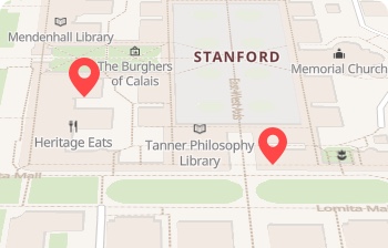
- GPS coordinates from your users’ devices are displayed on a map. Your systems draw a radius based on acceptable geographic reach. Relevant results are visually shown on the map as pointers
- GPS coordinates extracted from photos submitted by your users can be converted into areas. This can then be arranged and presented to users
Use cases

Asset Tracking
Lorem ipsum dolor sit amet, nsectetur adipiscing elit.
“We reduced both upfront product cost & ongoing costs by replacing GPS tracking with LocationAPI.”
Consumer Solutions
Lorem ipsum dolor sit amet, nsectetur adipiscing elit.
“We reduced both upfront product cost & ongoing costs by replacing GPS tracking with LocationAPI.”
Data Enrichment
Lorem ipsum dolor sit amet, nsectetur adipiscing elit.
“We reduced both upfront product cost & ongoing costs by replacing GPS tracking with LocationAPI.”